Knowwhereeverythingis.Always.
Tracking systems, risk intelligence portals, and operational dashboards for teams that move vessels, vehicles, and cargo through the real world.

What changes when it's done right.
Operational intelligence pieced together from feeds, spreadsheets, and phone calls
One live picture: incidents, positions, and risk zones in a single interface
Threat and status data arrives raw, in formats only one analyst understands
ETL pipelines that ingest, normalise, and surface external feeds automatically
Assets tracked on whiteboards and in radio check-ins
Live telemetry and BLE tracking feeding an operational dashboard
Risk assessments assembled manually for every decision
Risk scoring computed continuously, with drill-down when a call has to be made
The building blocks.
Geospatial risk mapping
Interactive maps with computed risk zones, colour-coded severity, and incremental updates that stay fast at global scale.
Incident tracking
Structured incident records with type, severity, location, timeline, and asset associations.
Feed ingestion & ETL
External intelligence and telemetry feeds ingested and normalised in pipelines isolated from the live portal.
BLE & asset tracking
Bluetooth and sensor-based tracking of assets, integrated into the same operational picture.
Ops dashboards & alerts
Role-based portals with search across incidents, assets, and zones, plus alerting when thresholds trip.
Reports & assessments
Threat and risk assessment authoring and export, generated from live data instead of copy-paste.
We've already built this.
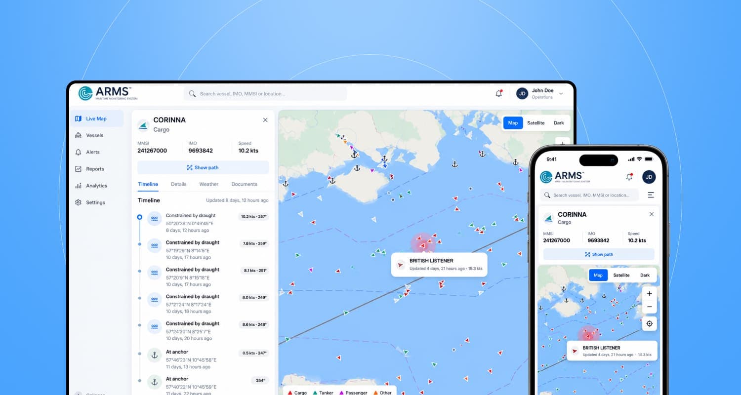
Dryad: Maritime Security & Risk Intelligence Portal
Real-time maritime security portal for Company Security Officers with incident tracking, geospatial risk mapping, and vessel intelligence.
- Geohash-based risk scoring enabling real-time threat zone visualisation on interactive maps
- Incident tracking with structured severity, location, and vessel association data
- WPI (Western Piracy Index) feed integration surfacing threat intelligence in context
Questions, answered.
The things people ask us before starting a project like this. If yours isn't here, ask us directly, we reply like humans.
Ask us anything→Can you handle live data at global scale?
Yes, and the trick is incremental computation. Our maritime risk platform updates geohash-based risk zones as incidents arrive instead of recalculating the whole grid, which keeps the live map responsive exactly when an operator needs it.
What if a data feed goes down or arrives malformed?
Ingestion runs in a pipeline separated from the live portal, so a failing feed never takes the operational picture down with it. Malformed records are quarantined for review rather than silently dropped.
Can this integrate with the tracking hardware we already have?
Usually. BLE beacons, AIS feeds, and sensor telemetry all reduce to the same problem: ingest, normalise, associate with an asset, and surface it. We build a processor per source format, the same pattern we use for bank feeds in our fintech work.
Who can see what in the portal?
Role-based access throughout, with an audit trail on sensitive views and actions. Security officers, analysts, and clients each get the picture appropriate to their role.
Do you understand the maritime domain, or just the software?
We built and ran a maritime security intelligence portal used by Company Security Officers, integrating piracy indices, incident data, and vessel intelligence. We won't pretend to be mariners, but we've learned the domain's data, decisions, and urgency first-hand.
Ready to craft tomorrow, today?
Where innovation meets execution, and ideas evolve into impactful solutions. Book a free consultation, no strings attached.